Description:
Shrines and sacred sites in Malawi have been in existence since 1500 A.D. They were used by our ancestors to offer sacrifices to their Mphambe (God) in times of drought or other calamities.
Khulubvi sacred shrine is a site where the Mang'anja people still worship the spirit of M'bona, a legendary figure with super human powers who lived in the area during the rise of the Lundu Kingdom.
M'bona is said to have had magic powers of bringing rain, creating wells of water on sandy lands, creating forests where they did not exist and hiding from enemies by turning into other creatures such as guinea fowls.
There are several auxiliary sites sprouting from this site which are all connected.
Description:
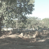
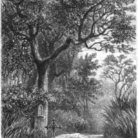
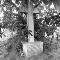
Bishop Mackenzie’s Grave on the east bank of Ruo River. Mackenzie led the first U.M.C.A. mission in Malawi (1862-1863)
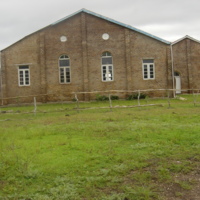
Description:
The Universities Mission to Central Africa (U.M.C.A) was established in 1857 with the purpose of bringing Christianity, health, education and equal trade to central Africa. It was initiated by Dr Livingstone at Cambridge. Dickinson and Scudamore were the first U.M.C.A missionaries in Nyasaland but sadly they did not live to see the fruits of their labour as they both died at Chikwawa in 1862-63. LOCATION TBC
Description:
Richard Thornton was born on the 5 April 1838 in Yorkshire, England. He attended grammar school in Bradford before entering the Royal School of Mines, London, in October 1855. After 2 years he passed his examination with great distinction and won a Government prize and the De la Beche Medal for excellence in geological studies. He joined Dr. Livingstone's expedition in 1862. Nine months later, on the 21 April 1863, Thornton died on board the boat 'Pioneer' in the upper reaches of the Shire River. He was 25 years old.
Description:
Herbert Rhodes’ grave near Kavalo Village. Herbert Rhodes (1845-1879) managed a cotton plantation in Natal, c1870, at first alone, then with his brother Cecil. Shortly afterwards, the discovery of diamonds at Kimberley led the brothers to abandon their interest in cotton and take up prospecting instead. However, Herbert had already developed an active interest in pioneering, and in 1871 he gave over his part in the claim to Cecil. He was eventually killed in a shooting accident whilst pioneering in the Lake Nyasa area. Herbert was an elder brother of Cecil Rhodes. He died on a hunting trip in 1879.
Description:
Early Banthu settlers in Malawi believed in offering sacrifices to Chisumphi/Mphambe (All Mighty God) through ancestors to pray for needs of the society such as rain when there was drought, healing when there was outbreak of diseases and thanks giving when they had good crop harvest. Several shrines are found around Malawi with the mother shrine being Kapirintiwa found between Malawi and Mozambique border in Lilongwe. Nyangu's shrine is one of the auxiliary shrines.
Description:
African Lakes Company warehouse and trading site on the east bank of the River Shire. Exact LOCATION TBC
Description:
Rock Paintings on Mikolongwe Hill. The site consists of red and white rock paintings which were mostly done by finger. The paintings have animal figures in white; and footprints, circles and sun-rays in red . The red paintings are much older than the white ones, dating to as early as the Iron age. The meanings of what was written vary from female initiation rites to a calendar pattern which depicts change of seasons.
Description:
Mwala wa Nthunzi means Rock that casts shadows (Mwala=Rock, Nthunzi-Shadow). The origin of the name is not clear, apart from the natural fact that the rock will cast a shadow when there is sunshine. The rock is shaped like a human/baboon skull with a hollowed forehead, long hooked nose, chicks and an upper lip. Traditionally there are beliefs that the rock harbours ancestral spirits proved by two supernatural occurrences: 1) It is impossible to circumnavigate the rock while whistling 2) When the colonial Government tried to remove it for a road to pass through the area, the rock would be found at its original spot in the morning, even when the road was tar sealed, spirits would return the rock. This would occur even after crashing and bulldozing the rock. Eventually, the road had to be diverted away from Mwala wa Nthunzi.
Description:
Seek advice from Dept of Antiquities and traditional authority for viewing
Description:
This was an ancestral burial site for leprosy victims. It also contains red rock paintings made by the Batwa (Pygmy) people.
Description:
Early Banthu settlers in Malawi believed in offering sacrifices to Chisumphi (All Mighty God) through ancestors to pray for needs of the society such as rain when there was drought, healing when there was outbreak of diseases and thanks giving when they had good crop harvest. Several shrines are found around Malawi with the mother shrine being Kapirintiwa found between Malawi and Mozambique border in Lilongwe. Thyolo shrine is one of the auxiliary shrines.
Description:
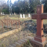
During the 30 year one party governance of Dr. Hastings Kamuzu Banda, four Government Ministers namely Twaibu Sangala, Aaron Gadama, Dick Matenje and David Sangala fell out of favour with the regime. They were found dead at Thambani in Mwanza on 18th May 1983. The then Government's version on cause of death was that the officials were fleeing the country and they met a fatal accident at the site. However, another version later emerged that the four were murdered and that the accident was staged. Proof of the actual cause of death remains unclear. The Memorial Pillar was erected in 2002 to honour the four.
Description:
Contains red and white paintings done by the Batwa (Pygmy) people. The oldest red paintings are about 2500 years old with some dating up to17th Century. The oldest white paintings were made 3rd Century AD and the latest were made in 20th Century AD.
Description:
1893-1902. Well preserved ruins on top of the pass between Mulanje and Mchesi mountains. The Fort was built to counter slave trade activities by some Yao chiefs in the Shire highlands who used the pass as a route to the Indian Ocean. It is on top of the pass between Mulanje and Mountain and Michesi Hill. It was an important Slave Trade Route used by Yao chiefs among whom were Mkanda, Matipwiri, Nyezerera and Kawinga. The Fort was built by Sir Harry Johnston in 1895 and named after Sir Harry Vilkers Lister of the Foreign Office. The environmental setting remains the same as it has been the time the forts were built, the same brachystegia trees remains within the property, no human encroachment has occurred.
Description:
Rock art sites around Phalombe. Ask Dept of Antiquities and TA for permission and advice
Description:
In 1991 over 500 people, mostly from Bokosi Village, lost their lives in severe flooding and landslides. Deforestation was thought to be the cause. This Pillar commemorates that event. Since then community re-forestation has been attempted to reduce vulnerability.
Description:
1888 Presbyterian mission site on the hill above the Phalombe-Mulanje road. Robert Cleland, from Monklands in Scotland, visited the area in 1888-1889 to climb the mountain. He was warned that strange people lived up there, who had no communication with the outside world. He was the first foreigner to discover the Mulanje cedar. He died a year later, in 1890, of Blackwater Fever.
In 1891 Dr Scott took up the work and a site was established at Linje in Chief Namonde’s area. Scott chose a second site at the foot of Chilemba peak near the source of the Linje stream, which is where the CCAP Hope Rest Cottage is to this day. In 1893 the Mission received title to the land.
The Cleland Memorial Chapel was opened in 1899 at the Mission, also known as Mt Zion. Built of burnt bricks and grass thatch, and with a spire which was said to be the very first of its kind in central Africa. By 1904 the Chapel was attracting a congregation of 200, the school had seven year groups, and there were various industrial craft projects. Boarding houses and District churches were established. However by the early 1930s the Mission moved to a larger site on the main Mulanje/Mozambique road.
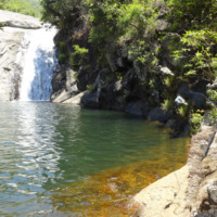
Description:
Pool below waterfall. Up the Likhubula valley, a 45 minute walk from Likhubula House. This pool and waterfall in the Likhubula River within Mulanje Mountain is highly revered as a home of spirits. Its name translates into ‘pool of the elder(s)’. There different accounts relating to the origin of the name. Some say there used to live an old man or woman. Others say only elderly people were allowed to go there.
Archeological evidence (pottery, beads, coins) show that the pool is regarded sacred and was used for rain sacrifices.
Description:
The Providence Industrial Mission is of major significance to the
history of Malawi as it was the source for the 1915 rising against the
British colonial government, an event that made its founder, John
Chilembwe, a national hero to this day. The church, based in
Mbombwe, Chiradzulu, had much support under disgruntled estate
workers. It is not surprising then that it had an early following
around Mulanje (Makondesa 2006). Before 1915 it already had many churches around Migowi, north of Michesi. South of Mulanje
Mountain its centre became located at Thabwa, north of Mulanje
Mission Hospital. LOCATION - Ask at Mt Mulanje Conservation Trust offices.
Description:
Built to counter the slave trade. At the confluence of the Muloza and Ruo rivers, on the site of what is now Mulanje town.
Description:
said to be 3km from the Mulanje Boma
Description:
Grave site of Nkhlanda chiefs, formerly slave traders who converted to Christianity. Main tomb recently repaired by Mulanje Mountain Conservation Trust. Two smaller important tombs require masonry conservation and scope for recording of wider grave site. LOCATION - Ask at Mt Mulanje Conservation Trust offices, or Mlalnje Mission Hospital
Description:
A prospective UNESCO world heritage site. There are 500 unique flora and fauna on this glorious mountain, scope for years of research and days of great trekking. Trekking and overnight stays in bothies (mountain huts) along good well defined paths. Mulanje mountain is a forest reserve so a guide is required - souyrced via the Forestry office or MMCT office in town. A guide will greatly enrich your experience and keep you safe.
Description:
Khulubvi sacred shrine is used by the Mang’anja people to worship the spirit of M’bona, a legendary figure with super human powers who lived in the area during the rise of the Lundu Kingdom.
M’bona is said to have had magical powers of bringing rain, creating wells of water on sandy lands, creating forests where they did not exist and hiding from enemies by turning into other creatures such as guinea fowls.
There are several auxiliary sites sprouting from Khulubvi which are all connected such as Khonde Dzimbiri and Nkhadzi (Nyadzikwi )Shrines. LOCATION TBC
Description:
A symbol of Africans’ resistance against colonial masters. In 1915 led by Rev. John Chilembwe against issues of Thangata (forced labour), African participation in the First World War, and acquisition of land by the Whites. Site of John Chilembwe's Church, demolished in 1915 after the uprising he led. Rebuilt in 1926 by Rev D.S.Malikebu.
Description:
Built between 1880 and 1890 by Donald Matola, it was used as a depot for slaves being transported to Chiwambo on the Indian Ocean. And also as a depot for forced labourers (Thangata) to work in farms within the Shire Highlands. Malota was a good labour recruiter for the settlers in the area and the name could easily derive from his legitimate labour activities
Description:
Built by the Montfort Missionaries. From this site, the Montfort Catholic Evangelists spread Christianity, education, medical care and industrial education.
Description:
An Archeological excavation was conducted that revealed that it was occupied by Stone Age people. Stone Age tools were excavated. LOCATION TBC
Description:
At Namaka on the Blantyre Zomba road. This was a mail station where mail carriers from Zomba and Blantyre exchanged their mail.
Description:
Built by John Buchanan from 1887 and completed in 1892 the building was the original town hall. in 1891 Sir Harry Johnston turned it into an office hence it became the first British colonial administration centre in Malawi. It entails the history of establishment of colonial rule in Malawi. The location was originally occupied by Ntaja's Stockade, from whom Johnston bought the land. Built in 1892 by John Buchanan, who introduced coffee growing to
Malawi. Currently occupied by various tenants. Condition sound, with
interesting historic finishes still around building, well, old brick making machine.
Description:
It was built in 1903 as an entertainment centre for the white population. Named Queen Victoria in memory of the Queen whose long reign had then just ended. Served as a Library, Cinema, and a Free Masons temple. In 1933 it became the Town Hall housing the first Blantyre Civic Offices until July 1986, when they were moved to a new building.
Description:
This Church was designed by Rev. David Clement Scott, a Church of Scotland missionary who had no formal training in architecture or construction. Its brick composition has remained structurally sound for over a century. Historically, the mission station of which it forms the centre marked the beginning of Blantyre city. The "Mission station" included Church, Offices, School, Botanical gardens and Industrial workshops much of which is still extant today. It is the first site of secondary and technical education in the country. It is important in the history of spreading Christianity in Southern Malawi and in the memory of early missionaries especially Dr. David Livingstone who apart from bringing Christianity, also brought civilisation and legitimate trade to this part of Africa.
Description:
First house to be used by Dr. Hastings Kamuzu Banda (first President of Malawi) in 1958.It was used as his office in the fight against Federation of Rhodesia and Nyasaland (present Malawi).The house was named after a State of Emergence which occurred on 3 march 1959 where Dr Banda was arrested. During the State of Emergency, Malawians stood up against their colonial masters to resist the federation of Rhodesia and Nyasaland; and to oppose arrest of Dr. Banda and other native leaders. Over 60 people were shot dead but the events led to the country getting its Independence in 1966.
Description:
Completed in 1882 as the residence of the African Lakes Company Limited's manager. The oldest existing building in the country. The Company was founded in 1878 by two Scottish brothers, John and Frederick Moir. John Moir was nicknamed Mandala (eye glasses) because he used to wear spectacles and Frederick was nicknamed Kandodo (Walking Stick) because he used to walk with a walking stick. The Manager's house was used as a trading centre from which porters carried goods for distribution to various Mandala stores It was also used as a resting place, a base for settlers and the first commercial bank in central Africa. From here the ALC launched their war on the Swahili-Arab slave traders in Karonga in the 1880s. The Mandala House today is owned by CFAO and is home to the Society of Malawi library and an excellent cafe.
Description:
It was constructed to commemorate and symbolise the bitter struggle that Malawians underwent in fight against Federation of Rhodesia and Nyasaland. It represents the sheer determination of the people. It was opened on 3rd July 1964 by H. E. Dr. Hastings Kamuzu, the founder of the Nation.
Description:
Built in 1906 by Roberto Sabbatini, Italian entrepreneur, possibly designed
by Scottish Architect Arthur James Stewart (speculative). In 1970s and 80s it was used by President Hastings Banda's Young Pioneers and subsequently caught fire in early 90's. Structural problems caused largely by removal of all first floor joists. Important historically both for its associations and quality of construction Original building at Mapanga Girls Training base.
Description:
Early Banthu settlers in Malawi believed in offering sacrifices to Chisumphi/Mphambe (All Mighty God) through ancestors to pray for needs of the society such as rain when there was drought, healing when there was outbreak of diseases and thanks giving when they had good crop harvest. Several shrines are found around Malawi with the mother shrine being Kapirintiwa found between Malawi and Mozambique border in Lilongwe. Michiru shrine is one of the auxiliary shrines. LOCATION TBC
Description:
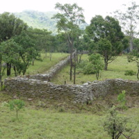
These were two ruins one Terraced Encampment and another a Stone Semicircle situated at lower slopes of Ndirande Mountain. The former structure was made of a series of well planned ridges 3000-400yards long and 50feet high. The latter ruin consisted of nine 1-2 metre high stones arranged in a semicircle. Considerable efforts were made in constructing the structures but their function remains a mystery. They seem to have been erected before 1922 the year when the area was declared a Forestry Reserve. The ruins were last monitored in 1979.
Description:
Erected in Memory of soldiers who died in World War I and II
Description:
It was erected by John Buchanan, a Scottish planter who acted as a British Consular official
Description:
Clock tower erected in memory of the men of the KAR (King's African Rifles) who died during both the First World War (1914-1918) and the Second World War (1939-1945).
Description:
Historic original mission site established by Livingstone and others. Built on earlier settlements which have been thoroughly researched (see book by Landeg White "Magomero")
Description:
Is a dark vertical hole on the northwestern edge of Zomba Plateau. Its depth has not been determined as it is very dangerous to go down the shaft. The name is derived from a notorious traditional authority (chief) who used the hole as a damp place for lepers, criminals (both dead and live), deformed babies and other unwanted people in the society.
Description:
Original U.M.C.A mission site and Burrup's grave, near Nasawa Training Base
Description:
Colonial administration. 1886-1888. Now the Government Hostel "Hotel Masongola".
Description:
Built during 1880s. Early mission station with church, clinic, school, and agricultural sites.
Description:
Located near the Bakili Muluzi bridge which crosses the Shire river at M'baluku area.
Description:
The clock tower was built in memory of Queen Victoria had ruled Great Britain and Ireland from 20 June 1837 until her death on January 22, 1901 at age 81. The Viphya Memorial was erected in memory of 145 passengers and crew who died when a passenger ship called Viphya sank on 30 July 1946.
Description:
The Hotchkiss Gun was used in the battle between the British and the Germany. It was operated from the Gun Boat called Guendolen and was used from 1899 to 1940. After it was rendered unserviceable it was dismantled some parts are mounted in Zomba, Mangochi Clock Tower and in The Lake Malawi museum
Description:
The five missionaries who pioneered Christianity in Malawi. They came to bring in good governance through the introduction of Christianity, Commerce and Civilization. The five died of Malaria in a space of three years from 1877- 1880. Dr William Black (1877), Shadrack Ngunana (an African missionary from South Africa who came to help with education) died of malaria and was buried alongside Dr Black, George Benzies, John Mackay and John Gunn.
Description:
The Otter Point waters are a unique feature that provide panoramic views. It is also a breeding point for Mbuna rock fish, a cichlid endemic to Lake Malawi.
Description:
The name Mwala wa Mphini in literal translation means "Rock marked with traditional scars" Its geomorphic formation presents a picture of scars that amaze locals and visitors. It dates back to the iron age. Many myths are told about the rock's origin and healing powers. Many believe it to be a sacred rock; local medicine men make healing and protective concoctions from aggregates of the rock.
Description:
The Viphya Memorial was erected in memory of 145 passengers and crew who died when a passenger ship called Viphya sank on 30 July 1946.
Description:
The Hochkiss Gun was used in the battle between the British and the German. It was operated from the Gun Boat called Guendolen and was used from 1899 to 1940. After it was rendered unserviceable it was dismantled some parts are mounted in Zomba, Mangochi Clock Tower and in the Lake Malawi Museum.
Description:
On Mangochi Mountain. Originally the stronghold of Jalasi the slave trader, the British turned it into a Fort after defeating Jalasi in 1895. Built in 1897 by the British. It relates to:
- the slave trade and its abolition
-The migration and settlement of the Yao
-Military history of Malawi.
-The most well preserved slave trade structure in Central-East Africa.
Its strategic and picturesque location on a mountain top offers a commanding view of the valleys and plains up to Mozambique. The environmental setting remains the same as it has been the time the fort was built, no human encroachment has occurred.
Description:
Historic shipyard currently operated by Mota Engil, with several Clyde-built ships in the harbour, including the Ilala II, the Mpasa and the Nkwazi. The oldest motor vessel in Africa, the SS Chauncey Maples was built in Rutherglen, Glasgow. The SS Chauncey Maples was designed by Henry Brunel and Sir John Barry and built by Alley & McClellan of Glasgow at a cost of £13,500.
'The Big Pull' - the 11-ton boiler being hauled overland to Lake Malawi
To transport the ship to Lake Nyasa it was disassembled into 3,481 parts, with an average weight of 25kg. The only part that had to be transported in one piece was the 11-ton boiler. It was shipped to East Africa and then towed on a barge and hauled overland by 450 Ngoni tribesmen, averaging five kilometres a day.
Unfortunately, when the parts of the hull were galvanised in Glasgow the numbering system was hidden, so the engineers in Malawi had to work out a huge jig-saw to re-assemble the ship. In 1901, two years after leaving Britain, the Chauncey Maples was successfully launched on Lake.
Description:
A tattooed geological site on road to Cape Maclear. The name "Mwala wa Mphini" in literal translation means "Rock marked with traditional scars". Its geomorphic formation presents a picture of scars that amaze locals and visitors. It dates back to the iron age. Many myths are told about the rock's origin and healing powers. Many believe it to be a sacred rock; local medicine men make healing and protective concoctions from aggregates of the rock
Description:
These sites were ancestral burial sites. The graves were opened before arrival of Dr. David Livingstone (Exact date not known) They ceased to be used as a burial site in 1893 after arrival of the British. It is recorded that the British influenced end of tribal conflicts in area and thus caused the original inhabitants of Nkudzi bay to move to another area hence closure of the burial site. The graves were used by Nyanja people and bodies were buried following the tribe's customs: the man will be buried on his back with arms on his sides and beads, tools and weapons will all be placed in his grave for use in the after life; while a woman would be buried with her ornaments and pots, some pots were found with chicken bones indicating possibility of inclusion of livestock in the pots. The sites are no longer traceable. LOCATION TBC
Description:
Chiusi Hills rock paintings are mostly red paintings done by the Batwa (Pygmy) people and are around 2000years old. The site is near St. Paul's the Apostle Seminary. Namaso Bay's paintings cannot be traced. LOCATION TBC
Description:
It was constructed in 1927 by the Ngoni tribe of Ntcheu in memory of their patriarch king and one of the greatest pre-colonial rulers of Malawi, Chief Gomani Chikuse I. When the British arrived in Ntcheu, they found him already a ruler over his people. He had many disagreements against the colonial governance. He was shot dead on 27th October, 1896 by a colonial administrator called Captain Ashton over managerial differences. After he was shot, his people constructed a Tomb at the place where he was buried (somewhere between Dombole and Chiole) as an indication of growing consciousness of colonial oppression. 1km NE of Ntcheu Boma.
Description:
an iron age hunter gatherer site with rock art. Mlanda is only 30Km from the Chentcherere site.
Description:
These are found at six rock shelters on the Chentcherere hill North of Dedza district. Located within the core zone of Chongoni Rock Art World Heritage site, the shelters contain two types of paintings; red and white. Red paintings are older than the white since the red are beneath the red ones. The red paintings are believed to have been made by the Batwa from as early as the 16th century while the white one are believed to have been by the Banthu speaking people.
Description:
Situated within a cluster of forested granite hills and covering an area of 126.4 km2, high up the plateau of central Malawi, the 127 sites of this area feature the richest concentration of rock art in Central Africa. They reflect the comparatively scarce tradition of farmer rock art, as well as paintings by Batwa hunter-gatherers who inhabited the area from the late Stone Age. The symbols in the rock art, which are strongly associated with women, still have cultural relevance amongst the Chewa, and the sites are actively associated with ceremonies and rituals. World Heritage Site. LOCATIONS several
Description:
At this site archeological excavations were conducted and skeletal remains of the small framed Akafula/ Batwa people were found. The findings proved the assertion that red rock paintings found at Chencherere rock shelter were indeed authored by them.
Description:
Built 1923, it is the first arch bridge to be built in Central Africa with roman architecture. Built and designed by captain Ernest, it had economic value as it enabled easy transportation of tobacco from Central to Southern Region. old bridge alongside new bridge on M1
Description:
The site is located between Nazipula and Nakayinga Rivers near Ntakataka Area in Dedza district. It was the Headquarters of Maravi Kingdom. The Archeological Site still exists and was last excavated in 1993.
Description:
Built by Father Claude Boucher. Named after a White Father, Champmartin, popularly known as Chamare by Africans, The museum aims at preserving, conserving, display and promoting both tangible and intangible cultural heritage. Museum, café, craft shops and restored village. Link to Catholic mission.
Description:
Commemorates soldiers who died during the First and Second World Wars; Malawian soldiers who died during different military operations both within and outside Malawi and Malawians martyred during the Independence struggle.
Description:
The monument is the last resting place for the first President of Malawi, Dr. Hastings Kamuzu Banda, who broke the Federation of Rhodesia and Nyasaland and brought Independence in 1964 and Republic in 1966. Mausoleum of HE Dr Hastings Kamuzu Banda, who led Malawi to independence and was the country's first President.
Description:
Early Banthu settlers in Malawi believed in offering sacrifices to Chisumphi/Mphambe (All Mighty God) through ancestors to pray for needs of the society such as rain when there was drought, healing when there was outbreak of diseases and thanks giving when they had good crop harvest. Several shrines are found around Malawi with the mother shrine being Kapirintiwa found between Malawi and Mozambique border in Lilongwe. Nyangu's shrine is one of the auxiliary shrines. LOCATION TBC
Description:
The shrine is located within a sacred forest in the village of Group Headman Tsang’oma, T/A Chiseka, west of Mitundu Trading Centre. The sacred forest is specially preserved as it is believed to be home for ancestral spirits. Believers go to the area in times of calamities such as droughts, to ask Chisumphi (God) for help. LOCATION TBC
Description:
The site is the first settlement area for the Chewa people when they arrived in Malawi. It also has a shrine associated with the rain making tradition. On one of the knolls within the area, it is believed that there are footprints of animals and people but these cannot be seen physically unless the visitors’ eyes are opened spiritually through rituals. LOCATION TBC
Description:
Early Banthu settlers in Malawi believed in offering sacrifices to Chisumphi/Mphambe (All Mighty God) through ancestors to pray for needs of the society such as rain when there was drought, healing when there was outbreak of diseases and thanks giving when they had good crop harvest. Several shrines are found around Malawi with the mother shrine being Kapirintiwa found between Malawi and Mozambique border in Lilongwe. Chirenje shrine is one of the auxiliary shrines.
Description:
Built in 1913, the site is one of the scattered Iron smelting furnaces found in Malawi. These sites represent a dawn of civilization in Central Africa. The period is associated with the coming of the Bantu speaking people to Central Africa who practiced iron smelting, farming, pottery and settlement. These activities revolutionised the region. Iron smelting resulted in the production of improved tools and implements such as hoes, spears, knives and axes. The site also portrays a unique method of manufacturing iron tools that is now extinct in Malawi.
Description:
The place where Malawi's first President, Dr. Hastings Kamuzu Banda received his first formal lessons. The monuments area comprises the Kachere tree which was used as a classroom, the drum tree where a drum which was used to call students hang, and Kamwala Well which was used as a source of water for the school. This site portrays the sheer determination and hunger for education that the masses had; despite difficult learning conditions such as learning from under a tree.
Description:
Iron Smelting Furnaces at Chulu and Dwangwa . The site is one of the scattered Iron smelting furnaces found in Malawi. These sites represent a dawn of civilization in Central Africa. The period is associated with the coming of the Bantu speaking people to Central Africa who practiced iron smelting, farming, pottery and settlement. These activities revolutionised the region. Iron smelting resulted in the production of improved tools and implements such as hoes, spears, knives and axes. The site also portrays a unique method of manufacturing iron tools that is now extinct in Malawi.
Description:
Red paintings made by the Batwa (Pygmy) people in the Kasungu National Park
Description:
In Kasungu national park. The site is one of the scattered Iron smelting furnaces found in Malawi. These sites represent a dawn of civilization in Central Africa. The period is associated with the coming of the Bantu speaking people to Central Africa who practiced iron smelting, farming, pottery and settlement. These activities revolutionised the region. Iron smelting resulted in the production of improved tools and implements such as hoes, spears, knives and axes. The site also portrays a unique method of manufacturing iron tools that is now extinct in Malawi.
Description:
Natural occurring hot water springs.
Description:
Built in 1896, on the Nkhotakota road. This fort was built by the British to deter Slave traders bringing slaves from Zambia to Nkhotakota from where used to get shipped to the East African Slave Market of Kilwa. LOCATION TBC
Description:
Built 1897.This fort was constructed by the British to deter Slave traders from bringing slaves from Zambia to Nkhotakota from where they used to get shipped to Slave Markets of Kilwa.
Description:
It was established by the Dutch Reformed Church Mission (D.R.C.M) who came to Malawi around 1888 to evangelise in the Central Region in Chief Mazengera's area. The mission was led by Andrew and William Murray. Apart from evangilization and formal education, they also encouraged agricultural activities.
Description:
It was established by the Dutch Reformed Church Mission (D.R.C.M) who came to Malawi around 1888 to evangelise in the Central Region in Chief Mazengera's area.
Description:
This cairm marks the place where the missionaries Murray and Vlock made their first camp. They established the Dutch Reformed Church Mission (D.R.C.M) in Central Malawi around 1888. The mission was led by Andrew and William Murray. Apart from evangilisation and formal education, they also encouraged agricultural activities.
Description:
Kaso Hill where Bible was translated into Chichewa
Description:
Built Between Nambuma and Dangaliro by the Chewa people to deter invasions from rival tribes, especially the Ngonis.
Description:
This is the first out station opened by the Universities Mission to Central Africa (U.M.C.A) in 1894 with the aim of spreading Christianity, education and giving medical care amongst freed slaves. The body of Bishop Chauncy Maples, the first Bishop of Likoma is buried inside the church.
Description:
At this tree Dr. Livingstone negotiated with Jumbe regarding freedom for slaves. One of major Slave Trade Routes was Nkhotakota where a Swahili-Arab slave trader, Salim-bin Abdullah (Jumbe) set up his headquarters on the shore of Lake Malawi in the 1840s. From Nkhotakota he organized his expeditions to obtain slaves and ship them across the lake to East African markets, Kilwa. About 20, 000 slaves (Pachai, P.A. 1968) were annually shipped by Jumbe to Kilwa from Nkhotakota. The captives were kept until they number 1000 and taken across the lake and then forced to walk for three to four month journey to Kilwa where they were sold.
Description:
Built by Jumbe, the Arab slave trader, who settled in Nkhotakota between 1840s-1895. This is the first mosque to be built in Malawi. It relates to the coming in of Islam, Islamic culture and also the impact of slave trade in Malawi. Ruins of Jumbe's mosque are still existing but Jumbe's grave has been eroded as lake levels have risen. Local guides can be found to take you on a walking tour.
Description:
1861 Dr Livingstone met Jumbe under the tree and again in 1864 Livingstone met Jumbe and Chewa chiefs here again to negotiate a treaty to end hostility and cease slave trading.
Description:
There are several hot springs around the district centre. Temperatures range from 65C to 80C. Near the District centre is Tambala area where around six hot springs are active. There isd also the Ling'ana hot spring situated 7Km on the road to Salima. At Karali 65Km NW of Nkhotakota there are hot springs welling up in the sand and in the lake. In addition to these, ten springs flow out of the bottom and sides of the Mawiri stream. LOCATION TBC
Description:
Built by the Chewa people to deter invasions from slave raiders and provide protection from attacks by rival tribes. LOCATION TBC
Description:
The second site of missionary work of the Free Church of Scotland's Livingstonia Mission led by Dr Robert Laws after the initial failure to establish a mission at Cape Maclear in memory of Dr. David Livingstone. Located on the northern lakeshore south of Nkhata Bay, after they moved north from Cape Maclear in 1881. Problems with fever meant this was a short stay before the final move up to Kondowe (Livingstonia) on the escarpment. Alongside Christianity the mission promoted education, medical and industrial services.
Description:
Nkhata Bay Boma. Comprise a memorial pillar where the Martyrs were shot, and graves. The graves are a resting place for 17 Malawians who were shot during the 3rd March,1959 State of Emergency which led to the killing of 31 Malawians protesters in Nkhatabay, 17 of whom were buried at this monument. It represents all Martyrs killed on this day for independence of Malawi.
Description:
Historic harbour where the lake steamers landed to load and unload cargo and passengers. Popularly known as "jetty" by the local people, the site is the focal point for social activities. Previously there was only one large ship, the M.V. Ilala, and it used to dock at the harbour twice a week. Villagers would flock to the area to admire her. Songs and stories were composed for her. The hospitality industry around the harbour flourished for it chartered for in-coming and out-bound passengers. To date, the harbour remains an important social and commercial area for the district.
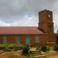
Description:
The Universities Mission to Central Africa (U.M.C.A) returned to Malawi in 1882 on Likoma Island after initial failure to set up a mission at Magomero in 1863. The main building of the cathedral was built from 1902-1905 and the library and a cloister were added in 1911. The mission aimed at spreading Christianity, education and promoting health care. Access via lake steamer or chartered flight.
Description:
It was built in 1889 by Dr. Walter Elmslie as an out station but later, a bigger church was built in 1894. It was located within a Ngoni tribal heart land. The Ngonis were notorious for fighting and conquering other tribes, therefore, the coming in of the missionaries facilitated end of conflict between Ngonis and Tumbuka tribes of the area. Life standards also changed for the better as schools, health services and general welfare of the people improved. Civilization came in the area and wars among tribes minimized.
Description:
Livingstonia extension. Established in 1880s by Donald Fraser. Founded by Dr Donald Fraser in 1884 as an outstation of Bandawe mission. It relates to the spread of Christianity, provisional of medical care, education and stoppage of hostilities between the Ngoni and Tongas.
Description:
Established by William Koyi in 1881 as an out station of Livingstonia Mission. It was the first station that the mission was permitted to establish in Inkosi ya Makosi Mbelwa I's area.
Description:
Memorial to Inkosi Ya Makosi M'Belwa I. He was the son of Zwangendaba, a great Ngoni leader who caused a wave of terror to tribes he encountered on his flight from Shaka Zulu of South Africa. After the death of Zwangendaba, there was a dispersal of the Ngoni at Songea, Tanzania due to succession disputes. The largest group under his son Mbelwa I migrated to settle in Mzimba, Northern Malawi. Mbelwa I raided and conquered many tribes around his settlement. The Tumbukas and Tongas were some of the victims of his raids. Inkosi Ya Makosi(meaning King of Kings) was the tittle given to Mbelwa I and all his successors, a name given to a paramount ruler of the Ngonis.
Description:
The Ngoni tribe originated from South Africa. A rebellious section of the tribe led by Zwangendaba decided to run away from the harsh reign of Shaka Zulu and travelled up to Tanzania through Malawi causing havoc and raiding kingdoms along their way. At Mabiri in Mzimba, Zwangendaba's son, Mbelwa I conquered and reigned over Tumbuka tribe. Ngoni reign on tribes they conquered was oppressive. This later led to rebellions. The success of the Tonga rebellion in 1876, influenced the Tumbuka to stage theirs in 1879. The most famous battle took place at Hora Mountain where a small group of Tumbuka warriors climbed the hill and rolled down huge stones towards the Ngonis who had surrounded the mountain. The Tumbukas were victorious on the first round of the battle, a rare victory at the time when the Ngonis were revered as invincible. The Tumbuka tribe was eventually defeated. The mountain is a site of pride for the Tumbuka people. It also has red rock paintings made by Batwa people long before settlement of Tumbukas in the area.
Description:
In 1894 the Livingstonia Mission moved up the escarpment from Bandawe. Monuments include Church, cairn, Post office, Clock Tower and Stone House (manse). Built in 1894 by Dr Robert Laws. It became the headquarters of the mission. It was named in honour of Dr .David Livingstone, one of early explorers and anti slavery activists. The site was also an early centre of Secondary and Technical education that also relates to promotion of health. It provides a visual historical evidence on the history of education and the spreading of Christianity. Schools belonging to this mission produced some of great minds of Africa i.e., Dr. Hastings Kamuzu Banda and Dr. Kenneth Kaunda the first presidents of Malawi and Zambia respectively.
Description:
Located some 8km south of Phoka court. The site is one of the scattered Iron smelting furnaces found in Malawi. These sites represent a dawn of civilization in Central Africa. The period is associated with the coming of the Bantu speaking people to Central Africa who practiced iron smelting, farming, pottery and settlement. These activities revolutionised the region. Iron smelting resulted in the production of improved tools and implements such as hoes, spears, knives and axes. The site also portrays a unique method of manufacturing iron tools that is now extinct in Malawi.
Description:
Fortification and stockade near Mpata. A major Slave Route was at Karonga where Mlozi, a Swahili-Arab, settled and Mlozi bin Kazbadema terrorized the Nkhonde people and seized them as slaves to Zanzibar. He organized surprise raids as far as Chitipa and Zambia. He also employed a number of the Swahili from Tanzania who undertook such expeditions. He, however, came into conflict with African Lakes Company, formed by Scottish businessmen John and Fredrick Moir in 1878. The Moir brothers traded and supplied the missions working in the country and provided a legitimate trade as opposed to the slave trade to the Africans. The African Lakes Company and Mlozi fought each other. The African Lakes Company, supplied and funded by the British Government, defeated Mlozi who was eventually locally tried by the Nkhonde chiefs and executed.
Description:
African Lakes Company which was funded by the British Government, came to Malawi in response to Dr. David Livingstone's call for the introduction of Commerce in Central Africa as a substitute to slave trade. The company established a permanent trading station at the site under a capable agent, L. Monteith Fotheringham, where they fought and defeated a notorious slave trader, Mlozi in the Arab Wars.
Description:
This is an unusually large Baobab tree (Adansonia digitata), which had long been used as meeting point for trade, political discussion and cultural events of the indigenous Ngonde people. This tree is the subject of fables and legend, both African and European. One of the most popular tales concerns the use of the tree in the defense of the Commissioners Office during the 1914-18 First World War; local inhabitants recall that a canon was mounted in the tree, while weapons were stored in a large hollow chamber within the tree. At that time, the tree had brickwork lining the hollow interior and was probably the only fortified tree in the world. The tree is also associated with Mlozi's slave trade. LOCATION TBC
Description:
Located near the Mpata Gap at Kasowa battlefield. Commemorating Jas Stevenson, Company Secretary of the ALC. The 7 metre high cross was brought by the people of Scotland and was erected in 1905 on top of Silu Mountain, about 16km west of Karonga Boma.
It was erected in honour of the commendable work done by James Stevenson, first chairman of Livingstonia African Company, and engineers James Stewart and William McEwen. The three played major roles in the initial implementation of the Stevenson Road which was designed to connect northern part of lake Malawi to Lake Tanganyika for trade and missionary work. Stevenson contributed €4000 towards the project.
Description:
Located along the Great African Rift Valley, the area contains tremendous amounts of fossiliferous deposits; Dinosaur and Chiwondo beds. This site has yielded important paleontological and geological discoveries which have shed more light into organic and geological evolution of Africa. The most outstanding discovery was that of a Dinosaur called Malawisourus(60 million years old) and rare pre historic crocodiles.
Description:
This fossiliferous horizon is within the Great African Rift Valley. It mainly contains Chiwondo beds. The site is an important area for continued pre historic research. Researchers have discovered a lot of data linking the systematics and evolution of early hominids (Australopithecus, paranthropus, early homo) from geological, ecological and paleontological data gathered found on this zone. Most outstanding findings were Malema Man and Uraha man (Paranthropus boispin).The Department of Antiquities in partnership with URAHA foundation (Malawi) run a site museum where some of the findings, including the dinosaur, are displayed.
Description:
The District Commissioner’s Office, the first colonial building to be constructed in Karonga. It is the oldest building that remains standing in the township and dates, most likely, to the turn of the century. Its architectural style is similar to that of Mandala House in Blantyre. Currently empty due to earthquake damage. LOCATION TBC
Description:
The Nkhonde kingdom was a well established kingdom in the Northern part of Malawi. The community kept cattle and were famous for banana farming. They lived during the slave trade period and they had managed to protect their village from Mlozi, a notorious slave trader, by sheer will power and use of locally made spears, knives, bows and arrows. However, Mlozi eventually managed to overpower one Ngonde village because he fought with guns against the latter's weapons. The whole village was wiped out; farms burnt, livestock butchered and strong young men and women taken into slavery.
Description:
Karonga is a border district connecting Malawi to Southern Tanzania. Malawi was a British protectorate while Tanzania was a German Protectorate. During the First World War both British and German soldiers who died fighting around this area were buried at these Graves.
Description:
Ruins within Chitipa town, which was once a British fort built to deter Slave traders, especially Mlozi.
Description:
Natural occurring Hot Water Springs. Various locations so take a local guide. Five hot springs are reported in the Chitipa-Karonga area. These include Chinuka, two at Mwankenja, Vungu, Mpata, Chiwondo and Ngala
Title: The Independence Arc
Description:
Title: The Independence Arc
Description:
❮
❯